
A squall line of severe thunderstorms have powered over the Midwest and will hit the western end of the Florida Panhandle on Saturday before impacting North Central Florida on Sunday.
The National Weather Service in Jacksonville issued an alert and has updated the forecast for the area. As of Saturday morning, the prediction shows damaging winds will be the most likely impact, with medium and almost high likelihood. Large hail, tornadoes and flooding remain possible but with lower chances in the medium likelihood section.
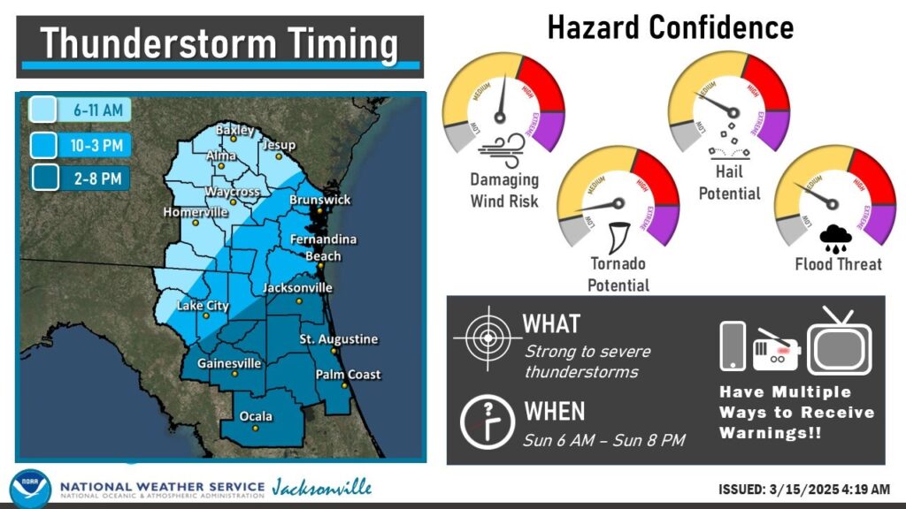
The storms will hit the area from 6 a.m. to 8 p.m. on Sunday. Lake City will see earlier impacts at around 11 a.m. to 2 p.m. with Gainesville, Ocala and areas toward the Atlantic Ocean seeing those storms later in the afternoon and evening.
The National Oceanic and Atmospheric Administration (NOAA) gave the storm system a 5 out of 5 high risk for severe weather on Saturday. Nearly all of Alabama is under a four or five risk for Saturday into Sunday.
In Missouri, several tornadoes touched down on Friday and into Saturday, leaving at least three dead and tens of thousands without power. The broken line of storms stretched from Wisconsin to Mississippi, according to CNN, who reported that the storm will likely gain strength and unleash its highest possible risk of tornadoes tonight and into early Sunday morning.
For more information, visit the National Weather Service.