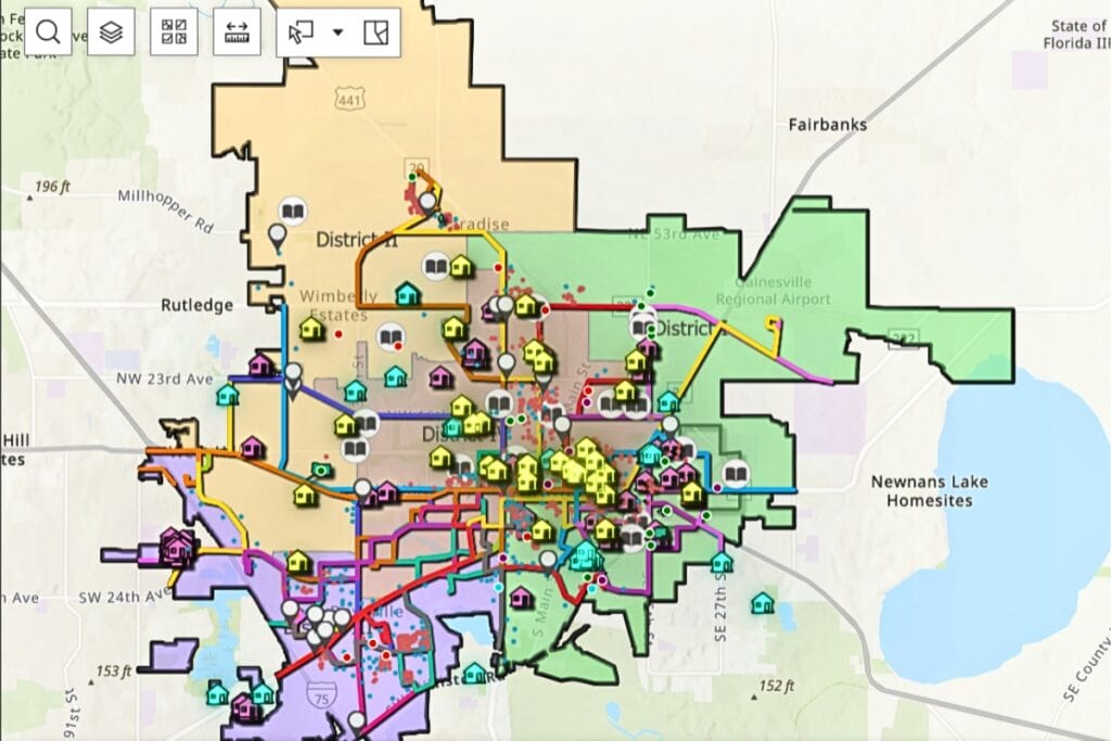
Gainesville residents can now visualize the city’s affordable housing efforts through an interactive map developed by city staff.
The city of Gainesville released the map on Thursday during a City Commission meeting. The map features current developments and funded housing programs stretching back two years, with overlays showing public schools, City Commission districts, Regional Transit System (RTS) routes and grocery stores.
“The ability to see this in the micro and the macro is absolutely extraordinary,” Commissioner Desmon Duncan-Walker said at the meeting. “Thank you staff for doing this. This is already exciting and very, very helpful.”
The Gainesville City Commission asked for the map, and City Manager Cynthia Curry said it is one method used by the city to support affordable housing.
“With this dashboard, neighbors can track the initiatives we’ve put in place,” Curry said. “The City is directing $12.3 million from the American Rescue Plan Act to expand affordable housing. This dashboard gives insight into our success rate as we work to increase that availability.”

Where can I access this map? Is it on city commission website?
There is a link in the first sentence of the online story. This is the link: https://www.arcgis.com/apps/dashboards/173d225bcec546da85ee907907caaf23.